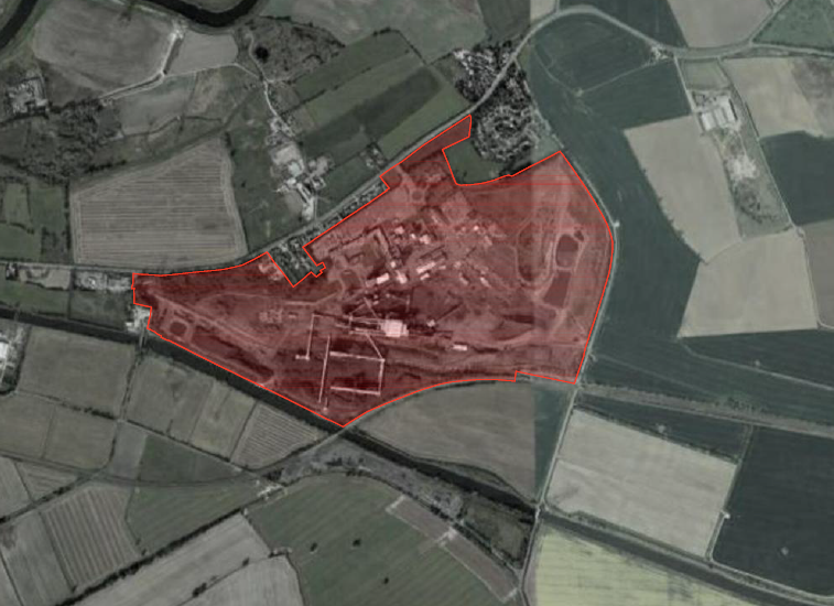
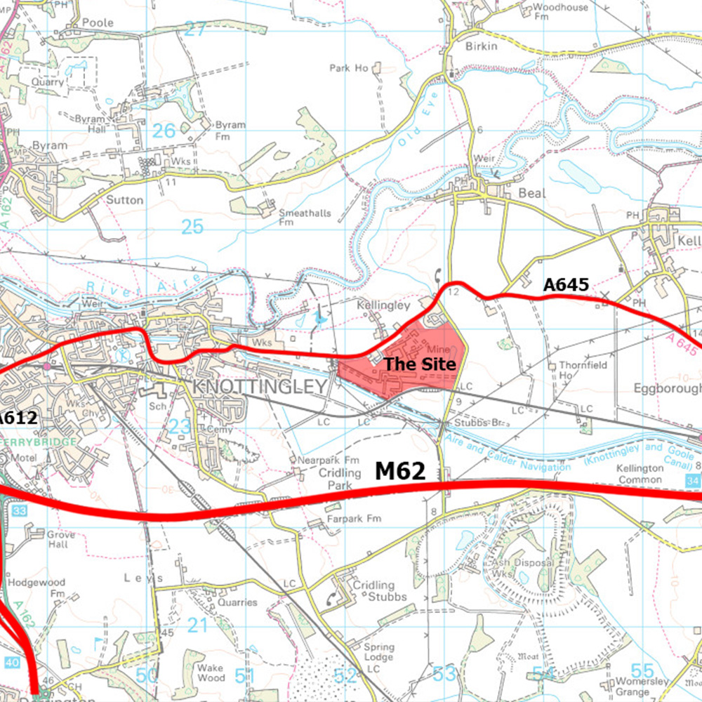
The Site and its Context
The Site is located approximately 2.5km (1.5 miles) to the east of Knottingley centre, adjacent to the village of Kellingley, and immediately to the south of the A645 Weeland Road which forms part the northern boundary of the Site. Sudforth Lane forms the boundary to the east, with the Knottingley to Goole railway line and Aire and Calder Navigation running along the southern and western boundaries. The western boundary of the Site also abuts Southmoor Lane.
The Site is approximately 64 hectares in size, and currently comprises the buildings which formed the Colliery including areas of car parking, landscaping and associated infrastructure. Plans are in place for the construction of an energy from waste facility known as the Southmoor Energy Centre on the south-west corner of the Site.
The Site is relatively flat and is currently occupied by a range of structures and materials stockpiles associated with the coal extraction. The tallest structures currently on the Site are the winding towers which are approximately 51 metres above ground level. Other infrastcutre on the Site includes two principal shafts (800m deep) with headgear, slurry ponds, coal preparation plant and associated facilities such as workshops, stores, staff amenities (baths etc) and offices.
There are a number of points of access to the Site, with the primary access being from Weeland Road (A645) which runs from east to west along the Site’s frontage. Additional access can be found at Sudforth Lane to the east and Southmoor lane to the west. Further details relating to the Site’s existing access points are detailed on the image opposite.
The Site includes existing railways sidings, which bisect the Site from east to west. In addition, it has an access to the Aire and Calder Navigation, which forms the boundary of the Site to the south.
A large majority of the Site is located outside the Green Belt within the open countryside, as defined on the currently adopted Selby Local Plan Proposals Map. The exception being a small area in the north-west corner of the Site which has always formed part of the operationally colliery but was included within the Green Belt when it was established in 1974 for reasons that remain unclear.