The Opportunity
The key to successfully designing a development scheme is that it reflects and responds to the opportunities and constraints that the site presents. Harworth have instructed a comprehensive team of consultants to assess the site and identify opportunities and constraints in relation to Topography, Highways, Landscape, Ecology, Ground Conditions and Coal Mining legacy issues, Drainage and Flood Risk, Air Quality, Noise and Cultural Heritage.
Landscape
The site is situated in within a low lying area of generally gently undulating landform and is bound by existing road infrastructure and the Aire and Calder Navigation, to the east of Knottingley, where the settlement pattern consists of warehouses and industrial estates. The dominant land use surrounding the site is agricultural, consisting of a variety of field patterns and sizes and exhibiting an open character, which results in the large scale features of Eggborough and Knottingley power stations, and the former colliery being prominent features and exerting an industrial character to the landscape. The site is not covered by any landscape designations, is not within a Conservation Area, nor does it contain any Listed Buildings or Public Rights of Way.
The proposed scheme provides an opportunity to redevelop the former colliery with well-integrated built form, reducing the visual impact of the former colliery and introducing measures to enhance the existing biodiversity through new green infrastructure.
Transport and Access
The site already benefits from an existing access onto Weeland Road (A645) which during peak operation of the Colliery accommodated a large number of vehicles entering and egressing the site. The scheme proposes to utilise the existing vehicular access onto Weeland Road (A645).
A secondary access is also proposed onto Sudforth Lane which runs along the site’s eastern boundary.
A qualified highways consultant has been appointed to fully assess the capacity of the existing highway network and its ability to serve the proposed scheme. A highways consultant is present at this consultation event to answer any queries you may have regarding this ongoing assessment.
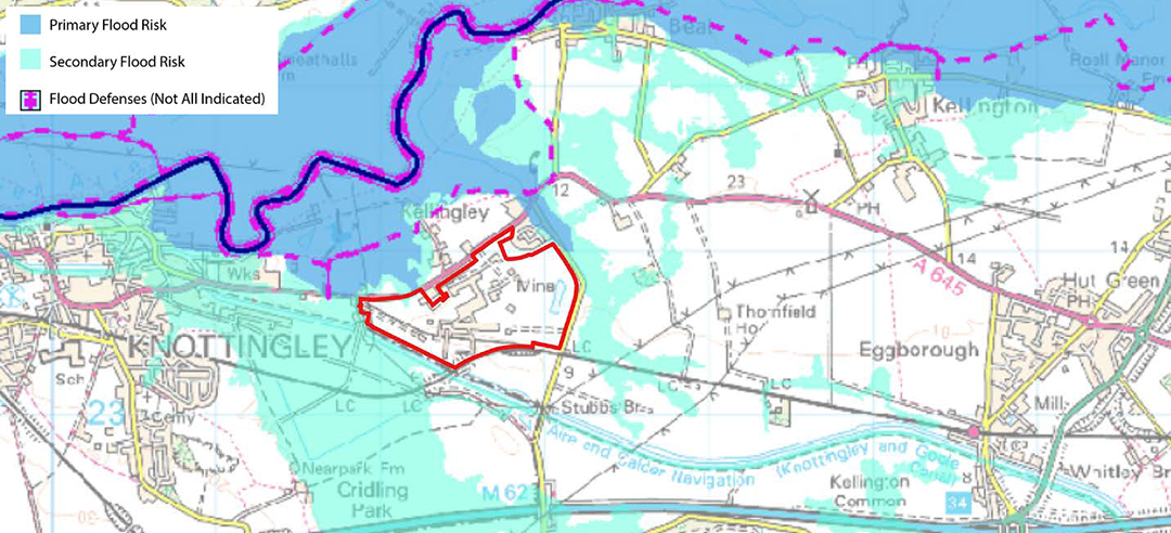
Topography and Drainage
The development will be sited within Flood Zone 1 and therefore at the lowest risk of flooding. Given the size of the site, a comprehensive positive drainage scheme will be prepared by drainage experts. Working alongside officers within North Yorkshire County Council, a drainage scheme is currently being prepared which will incorporate the use of Sustainable Urban Drainage Systems (SuDS) and additional areas of attenuation. The detailed scheme will ensure that all surface water runoff is contained on site and discharged at an appropriate rate.
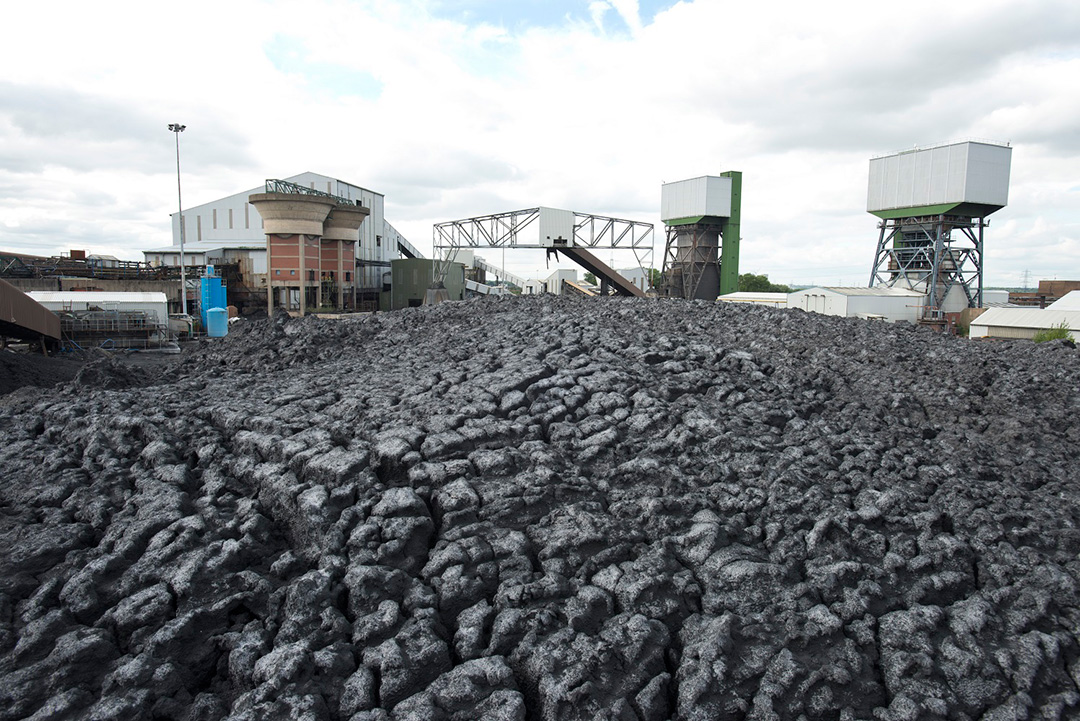
Coal Legacy
Given the site’s former use, careful consideration needs to be given to any associated legacy issues. Harworth and their consultants have looked in detail at these issues and a report on them will accompany the final planning application.
Ecology
Given the former use of the site, it is widely considered to be of minimal ecological value. Harworth have however instructed ecological consultants to conduct an extended Phase 1 Habitat Survey, Bird and Bat surveys.
The findings of these surveys are currently being finalised but the initial conclusions are that there are no protected species which would preclude development on the site. The final reports will also suggest ways in which the ecological value of the site can be enhanced. These measures will be incorporated into the final proposals